Henrico County, part of Virginia’s Capital Region and the Chesapeake Bay watershed, is home to more than 330,000 residents and an active economy. Henrico County managers strive to encourage responsible growth and development in the region while balancing environmental protection considerations. One of those considerations is acquisition of compensatory mitigation credits for authorized impacts to stream and non-tidal wetlands for Henrico County transportation projects, as required by Clean Water Act Sections 404 and 401 and Virginia state regulations.
Mitigation credits are typically generated from wetland and stream restoration and creation projects on private land and made available for sale publicly through mitigation banks. Mitigation credits must be purchased withing the same Hydrologic Unit Code (HUC) 8-digit watershed the impact is occurring in or from an adjacent HUC-8 watershed. With the rapid increase of growth experienced in this region, mitigation credits have been scarce.
To address the need for mitigation credits that have not been available in the marketplace, Wetland Studies and Solutions, Inc. (WSSI) has been working with the Henrico County Department of Public Works to develop a Single-User Umbrella Mitigation Banking Instrument (UMBI) to offset wetland and stream impacts incurred in county projects. With an UMBI structure, Henrico County will be positioned to incorporate additional sites that would benefit from stream and/or wetland restoration to expand the county’s own capacity to address ever-changing mitigation needs. The jointly-developed UMBI currently awaits approval from the Interagency Review Team (IRT), led by the U.S. Army Corps of Engineers and the Virginia Department of Environmental Quality.
A Pilot Site
New Market Park in eastern Henrico County, a ±219-acre (±88.6-ha) parcel, was identified as the pilot mitigation bank site. If approved by the IRT, it would be the first site for this UMBI.
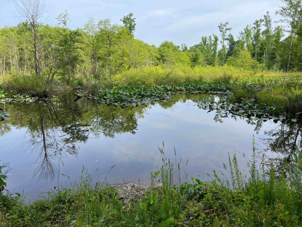
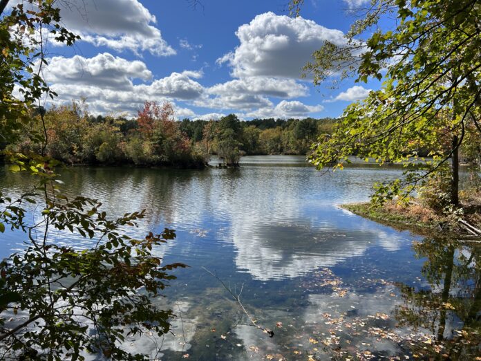
The site is surrounded by land in conservation and is bisected by Four Mile Creek, a tributary of the James River. At its heart, the site has a decommissioned sand and gravel borrow pit, which is now a shallow pond supported by groundwater (Figure 1). Beaver activity within Four Mile Creek has created extensive wetlands and split the main channel into multiple tributaries, or branches, that reconnect to the main channel downstream of the wetland system, all of which could be compromised if the beavers leave or if their structures fail (Figure 2).
The proposed site work includes stabilizing beaver-impounded areas, as well as the streams affected by the impoundment, and altering the hydrology of the shallow pond to create wetlands. More than 29 wetland mitigation credits will be developed through wetland creation, wetland enhancement and upland buffer restoration and preservation. An additional 1,400+ stream mitigation credits will be developed through stream restoration and preservation.
The project development is in full swing and has included a full range of natural and cultural resources investigations as well as preliminary design for the site.
Environmental Investigations
WSSI scientists and surveyors have delineated wetlands and other Waters of the U.S. and Commonwealth of Virginia, and survey-located those features so any impacts and enhancements can be accurately accounted for. Because the site contains potential habitat for the state-endangered swamp pink (Hellonias bullata), WSSI completed a search to ensure survival throughout construction if communities were present on the site; no individuals were present.
A Phase I Environmental Site Assessment was conducted to uncover any potential site contaminants, because it is critical to understand the negative impacts previously experienced in the landscape and waterways. While this site did not require further study or remediation, some sites do.
WSSI also completed an invasive plant species survey because invasive species can wreak havoc on ecosystem balance for plants, animals and the soil. The survey allows for responsible site planning, including removal of plants that can damage the proposed mitigation site’s ecological integrity. The survey identified Japanese stiltgrass (Microstegium vimineum), marsh dewflower (Murdannia keisak), sericea lespedeza (Lespedeza cuneata), golden bamboo (Phyllostachys aurea) and Chinese privet (Ligustrum sinese). These species are common in disturbed areas in the region and often outcompete native species that better support ecological diversity. Fortunately, most of these species can be managed through repeated herbicide treatments and mechanical removal.
Cultural Resources
WSSI’s cultural resource specialists conducted a Phase I archeological and architectural field investigation of the project area, which is entirely within the boundaries of the New Market Heights Battlefield, First Deep Bottom Battlefield; and Bailey’s Creek/Second Deep Bottom Battlefield theatres of the Civil War. The Phase I investigation augmented shovel test pits with systematic metal detection, following Virginia Department of Historic Resources battlefield guidelines.
Building upon previous studies performed on portions of the site, field archaeologists spent several months expanding the surveyed limits of known prehistoric sites and Civil War earthworks, identifying similar new sites, and recovering hundreds of artifacts ranging from prehistoric Early Woodland stone tools/fragments (1100 B.C.E. – 500 B.C.E.) to lead Minié balls fired amongst brethren during the Civil War.
The curation of these artifacts and documentation of field efforts was performed in accordance with the Virginia Department of Historic Resources (DHR) guidelines. Knowing the boundaries of these historic sites allows designers to avoid critical areas and provides opportunities to connect the public to these significant places through careful placement of trails and interpretative signage. The mitigation plan for New Market Park avoids critical cultural resources. If impacts were proposed, mitigation, often consisting of additional fieldwork and expanded investigative reporting on similar features in the region to place the features in a broader historical context, would need to be agreed upon through coordination with the DHR, IRT and the design team.
Stream Channel Survey for Engineering
Investigators also evaluated stream channel conditions and surveyed representative stream channel cross sections to support design processes. The data obtained informs design engineers as to the erosion, sediment transport and water velocity in the stream and if the stream has a connection to its floodplain. With that information WSSI can identify how site hydrology is influencing the stream channel and which features can be engineered to ensure that the stream restoration design is robust and accounts for site-specific issues.
Existing Conditions Survey
WSSI performed an existing conditions survey to accurately document the locations of existing infrastructure such as existing fences, trails, upstream and downstream bridge dimensions, visible utilities, and culvert and storm structures, as well as stream and riparian features. This survey effort also established site control using Real-Time Network GPS and conventional survey techniques for use throughout the duration of the project. Bathymetric survey data was collected within the site limits of the pond occupying the decommissioned sand and gravel borrow pit (±17 acres or ±69,000 square meters) and included spot shots and 1 foot (±30 cm) contour interval topography. Additionally, elevation data was collected within the site limits of the four tributaries that are being considered for inclusion in the restoration effort (the stream and 25 feet (7.62 m) landward of top of bank) and included 0.5 foot (±15 cm) contour interval topography within these areas.
Engineering and Permitting
The prospectus and initial results of the due diligence efforts (environmental and cultural resource assessments) were used to develop a site development plan and a preliminary mitigation work plan for this project, which will be incorporated as a site in the proposed UMBI.
At the conclusion of site investigations and with feedback from the county and the IRT, WSSI will prepare a final mitigation work plan and prepare and submit a pre-construction notification and supporting documentation to the U.S. Army Corps of Engineers requesting authorization of the stream restoration project under Nationwide Permit #27.
It is WSSI’s hope that New Market Park will be the first of many sites to be included in the Single-User UMBI for Henrico County. This approach to generating compensatory mitigation credits creates a reserve of credits exclusively for Henrico County projects in a high-demand market while ecologically uplifting sites in the immediate vicinity of the inevitable impacts associated with responsible development.

About the Experts
- Beth Silverman, PWS, is the marketing manager for Wetland Studies and Solutions, Inc., a Davey company. Her background in ecology and policy informs her approach to sharing information with a range of audiences.
- Stephen Stone, PG, PWS, is a hydrogeologist with Wetland Studies and Solutions, Inc., a Davey company. He contributed to the development of Wetbud, a wetland water budget modeling software package funded by the non-profit Resource Protection Group, Inc., and he works to identify and develop stream and wetland mitigation sites.


