

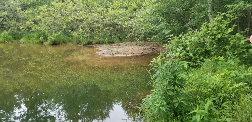
It often takes a long time and a lot of data to begin to understand what is affecting water quality on a site or in a watershed. A recent study in the mountains of North Carolina, USA, used volunteers to obtain water samples over several years to estimate sediment loading to a 6,200 ac (2,509 ha) reservoir.1 The two main streams feeding the reservoir and the dam outlet were instrumented with water level gauges to estimate flows. Volunteers obtained close to 500 stream samples during and after storm events, including at the stream gauges. In addition, there were three high-frequency sampling events in which hourly samples were taken before, during and after storm events. Samples were measured for turbidity (in nephelometric turbidity units, or NTUs) and a subset for total suspended solids (TSS). A regression equation was calculated between turbidity and TSS to estimate TSS on samples that had only turbidity measured. Under base flow conditions, the water was relatively clear (1–20 NTUs), but it often exceeded 1,000 NTUs during storm events (Figure 1). The highest turbidity and TSS were usually just before and at the peak flow, with water clarity returning as flow subsided. Peak flows in the larger stream were in the 176–211 ft3/s (5–6 m3/s) range for three storms and 35 ft3/s (>1 m3/s) for 35 storms, with the highest flow in the other tributary at 78 ft3/s (2.2 m3/s). Estimated sediment loads to the reservoir from the two tributaries were 654–916 yd3/yr (500–700 m3/yr), with about 13% coming from the three largest storms. Coarse sediment could be seen deposited at the mouth of the streams (Figure 2), although much of the sediment was deposited throughout the lake. The homeowner’s association that owns the lake had recently had 920 m3/yr (1,200 yd3/yr) dredged from the lake, which the authors point out is less than two years of sediment accumulation. As a result of the study, they are considering installing forebays to help retain the sediment near the shore, where it would be easier to remove without lowering the lake level.
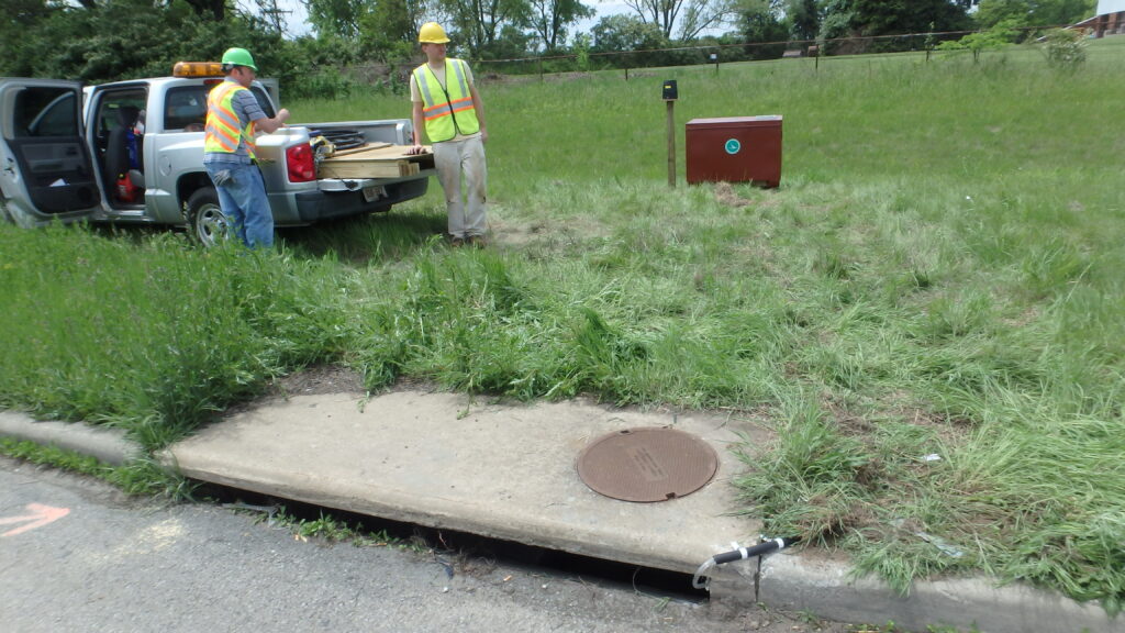
On a very different scale, runoff into road stormwater drains was monitored in Ohio, USA, to determine the particle sizes and sediment loads2 (Figure 3). Watersheds ranged from 0.025–0.45 ac (0.01–0.18 ha), and road types ranged from small state roads to high-speed interstates carrying 7,000–131,000 vehicles per day. The sites were monitored for 26–52 events, for a total of 490 events, and particle size distribution (PSD) and TSS were determined for a subset of these. The PSD was of interest in determining how well various stormwater control measures might work to remove sediment from road runoff. Rainfall durations were greater in fall and spring compared to summer, but intensities were greater in the summer. TSS concentrations averaged 35 mg/L over all sites, which was relatively low compared to data from other studies. Concentrations were not related to traffic volume or rainfall characteristics, which suggests other factors were involved. Sediment loads averaged 0.9–12 lb/ac (1–13 kg/ha) per storm event for the 11 sites, with annual loads ranging from 95–508 lb/ac/yr (107–569 kg/ha/yr). The PSD varied across sites but averaged around 4% clay, and the remainder was evenly divided between sand- and silt-size particles. The median particle size ranged from 24–72 µm (<400–200 mesh) and was influenced by nearby land use, with low-density residential areas having the largest particles. The two roads with the most traffic also had the smallest PSD, which suggests that particles were being pulverized during dry periods. Using published sediment capture rates for different stormwater control measures, the authors suggested that dry detention basins and wet pond/wetland devices could achieve an 80% reduction in sediment loads based on the PSDs in the study. Filter strips and swales may need to be paired with other measures to achieve similar removal rates.
References
- Wilcox JD, Stark KA, Svetlov R. 2024. Estimating Stream Sediment Loads to Assess Management Options for a Southern Appalachian Mountain Lake. Environmental Earth Sciences 83:387.
- Winston RJ, Witter JD, Tirpak RA. 2023. Measuring Sediment Loads and Particle Size Distribution in Road Runoff: Implications for Sediment Removal by Stormwater Control Measures. Science of the Total Environment 902:166071.
About the Expert
Rich McLaughlin, Ph.D., received a B.S. in natural resource management at Virginia Tech and studied soils and soil chemistry at Purdue University for his master’s degree and doctoral degree. He has retired after 30 years as a professor and extension specializes in the Crop and Soil Sciences Department at North Carolina State University, specializing in erosion, sediment and turbidity control. He remains involved with the Department as professor emeritus.


