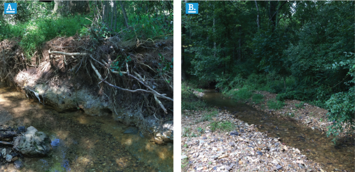
Humans have attempted to “tame” streams through channelization and bank hardening for centuries. More recently, a better understanding of stream processes and ecosystem services has led to efforts to return them to a more natural state when possible. Two recent studies have taken very different approaches to gain further insights into stream dynamics as affected by potential or actual interventions.
In one study, a large model stream was constructed under laboratory conditions and the effects of sediment inputs and different stream-widening strategies on stream morphology.1 A model stream was established on a 4-meter-by-32-meter platform with a 1% slope. A trapezoidal channel was established with one bank non-erodible while the other bank had a 22-meter section that was erodible and also represented a potential flood plain. Based on a reference stream, flows were scaled to represent either 1.5 (bed-forming) or 30 (unsteady flood) return periods. Sediment was injected at rates representing 100, 80, 60 and 20% of stream capacity, determined based on outlet sediment delivery. Several variables were also tested, including a deflection device on the stable bank to initiate erosion on the erodible bank, and two cuts in the erodible bank also intended to initiate erosion. A little bank erosion occurred at the two lower sediment loading rates, but the channel widened considerably at the higher sediment loading rates. Channel widening to generate sediment and prevent the high shear, single thread channel that low sediment flow promotes was the objective, but the deflection device had little effect on bank erosion. However, two jagged cuts in the bank did initiate the erosion process. This “dynamic river widening” process was expected to take years to decades to stabilize. The authors recognized that having sediment supply at the stream transport capacity may not be desirable for a number of reasons but suggest that stabilizing a stream will require consideration of the potential sediment availability in the system.
Another approach to studying stream dynamics is to obtain measurements of their properties over time, which was what Williams et al. did.2 They evaluated 17 years of annual stream cross-section measurements from four headwater streams in a portion of Montgomery County, Maryland, USA, in the Chesapeake Bay watershed. The stream watersheds included one that was 86% forested with little disturbance, one that was primarily agricultural with some suburban development in the later years and two that went from 4% to either greater than 30% or 45% impervious cover during the measurement period. The developed watersheds had either 144 or 274 stormwater practices per square kilometer by the end. The types of stormwater practices were somewhat different in the two developed watersheds but included tree boxes, recharge chambers, infiltration trenches, underground detention, sand filters and dry basins. All runoff from impervious surfaces in these watersheds went through a stormwater practice. The forested stream was surprisingly dynamic, with increases in bankfull width, channel area and channel deepening, but the authors considered it near “quasi-equilibrium.” The agricultural stream was in a widening and aggradation phase primarily. The stream with the less recent development was primarily in the incision phase (Type II) and the one with more recent development in widening and aggradation phases (Types III and IV). The authors suggested that the stormwater practices in the earlier developed watershed may be more effective than those in the more recent developments, but variations within each watershed could have been a factor. There was more sand during earlier development compared to the more recent construction activity, which this reviewer suggests could have been from improved sediment basin designs.
References:
- Rachelly, C., D. F. Vetsch, R. M. Boes, and V. Weitbrecht. 2022. Sediment supply control on morphodynamic processes in gravel-bed river widenings. Earth Surface Processes and Landforms, 47(15), 3415–3434. https://doi.org/10.1002/esp.5460.
- Williams, B. M., K. G. Hopkins, M. J. Metes, D. K. Jones, S. Gordon, and W. Hamilton. 2022. Tracking geomorphic changes after suburban development with a high density of green stormwater infrastructure practices in Montgomery County, Maryland. Geomorphology 414 (2022) 108399. https://doi.org/10.1016/j.geomorph.2022.108399.
About the Expert
Rich McLaughlin, Ph.D., received a B.S. in natural resource management at Virginia Tech and studied soils and soil chemistry at Purdue University for his master’s degree and doctoral degree. He has retired after 30 years as a professor and extension specialist in the Crop and Soil Sciences Department at North Carolina State University, specializing in erosion, sediment and turbidity control. He remains involved with the department as professor emeritus.


