

Overcoming Challenging Weather and Terrain
By Hannah Giess
The Ara Tūhono–Pūhoi to Warkworth Project is an 18.5-km motorway extension currently being built north of Auckland, New Zealand. The motorway is designed to offer a safer and more reliable travel route than the existing state highway and connect the Northland Region with the upper North Island freight network.
The Waka Kotahi NZ Transport Agency project is being delivered by the Northern Express Group (NX2) under a Public-Private Partnership (PPP) delivery model. Fletcher Construction and Acciona Infrastructure have been contracted in a construction joint venture to construct the motorway on behalf of NX2.
Enabling works, or site preparation, for the motorway commenced late 2016, and the motorway was scheduled to open at the end of 2021, but the New Zealand nationwide COVID-19 ‘Alert Level 4’ lockdown in March and April 2020 meant nearly six weeks of the key earthmoving season was lost. The resumption of work under ‘Alert Level 3’ with strict health and safety protocols also impacted the works programme. The motorway is now expected to open to motorists in May 2022.
A Challenging Environment
The project setting is largely characterised by low, undulating hill country in the north, and steeper rolling hill country, with distinctive complex incised landforms of interconnected ridge and valley systems in the central and southern parts. To add to the challenging geological environment, Auckland has a highly variable subtropical climate, which restricts earthworks to a seven-month ‘earthworks season’ period during summer months which tend to be warm and humid with typically less consistent rainfall. The average annual rainfall for Warkworth is 1,454 mm.
During the first earthworks season (2017/2018), the project received 202% of the normal summer rainfall. This was Auckland’s second wettest summer on record, which occurred when the project was trying to “get out of the ground.” The wet summer significantly slowed progress on gully muck outs, drainage improvements and culvert work, putting us on the back foot for bulk cut to fill earthworks during this first earthworks season. This meant the start of most of the bulk earthworks was pushed to the next earthworks season.
The challenging steep terrain along much of the project alignment has meant that many of the overlying soils were either unstable, or highly susceptible to erosion when exposed by construction activities. By comparison, the northern length of the project contains extensive alluvial deposits in low lying areas carved out by major rivers and subsequently infilled with deep, soft estuarine and alluvial sediments.
The underlying geology also strongly influences the groundwater along the length of the alignment with elevated groundwater levels, seepage lines, springs and perched leaky water tables common from north to south. This complex geology required extensive ground improvements and stabilisation mechanisms, resulting in over two million cubic metres of additional dirt and rock to move on top of the original 7.5 million scope. Not only do these geological challenges create many technical and constructability issues, but they also present significant environmental challenges when it comes to building erosion and sediment control devices.
One of the toughest challenges faced by the project team are the various landslides, the largest being a 60,000-cubic metre slip in the steepest gully of the project. An immense effort was required to divert water from and around this slip material when a 200-mm rainfall event was predicted for the coming week. This required the installation of a larger secondary 1050-mm diameter culvert line over 140 m, in addition to the base 650-mm culvert already in place, and provision of an emergency overland flow path higher on the southern bank away from the slip failure zone.
Erosion Sediment Control
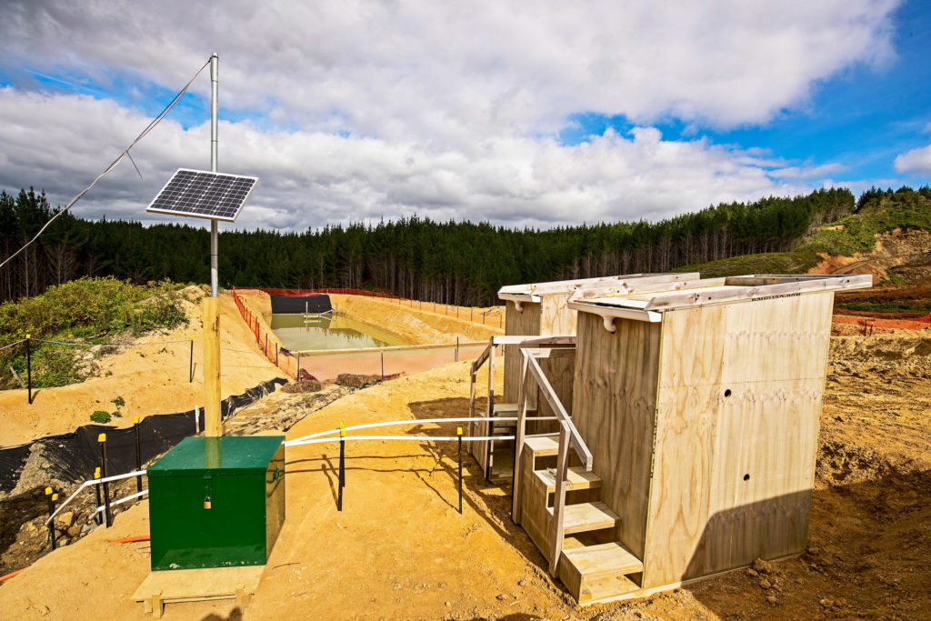
The ground conditions and wet first earthworks season meant the project has had to look for innovative ways to manage run-off when traditional erosion sediment control (ESC) devices, such as sediment retention ponds (SRPs), cannot be built.
Designing and building erosion and sediment controls in a diverse landscape has presented unique challenges. The steep hill country often required sediment retention ponds (SRPs) to be located at the bottom of steep gullies in highly erodible and unstable ground conditions with difficult access. In some instances, floc dosing hoses run for over 50 m to enable a safe accessible location to refill chemical treatment.
In the flat country the alluvial soils meant ground conditions were often not sufficient to support ESC devices so alternative solutions such as dewatering tanks were required.
Adaptive Monitoring Framework
Despite the challenges the environment presented, the project’s response to environmental management has quantitively demonstrated that the structural and non-structural ESC practises are exceeding expectations when it comes to the reduction of potential sediment discharged from site.
The project’s regulatory framework for ESC is founded upon an adaptive monitoring framework, which uses a “plan-do-check-act-learn” approach. This ongoing monitoring and reporting create a continuous feedback loop that can subsequently assist and improve the environmental measures, monitoring methodology and general works.
The project has no set regulatory suspended sediment discharge standard in place, however through intensive data collection and analysis during rainfall events, the project has demonstrated that the sediment yield during construction has to date been several orders of magnitude below that which was initially predicted during the consenting phase using theoretical modelling such as GLEAMS and USLE.
The projects sediment yield is calculated through monitoring required under the project’s resource consent conditions. A manual grab sample is taken at the outlet of all SRPs during or immediately after rainfall events that exceed 25 mm/24-hour and/or 15 mm/hour–known as “trigger events.” These water samples are sent to a lab to determine total suspended solid (TSS) concentrations. The sediment yield is calculated using the TSS, “earth worked” area and rainfall volume. The manual grab sample is then validated through data collected from the project’s four automated sampling units that take water samples throughout the full lifecycle of a rainfall event. The samples are also analysed for TSS at the lab. The automated TSS data provides the “peak” result which can then be used as a multiplier for the manual TSS sample and used to calculate a ‘worst-case’ sediment yield.
The results from post trigger water samples, in addition to observations made during trigger event inspections, are used to inform modifications that may be required in relation to ESC. There may be a subsequent action to put in place including alternative measures to manage ESC if existing measures have been unable to achieve their theoretical outcomes. For example, a poor water quality result (high TSS), in a sediment retention pond may be the result of changes in the soil type of the catchment as cuts have progressed, which has changed the optimum chemical treatment dosage required. An adaptive response would be to undertake a bench test of the soil type within the catchment to determine the best dose rate, then update the chemical treatment (flocculant) volume through updating the floc shed (rainfall activated dosing system) design.
Through monitoring of SRP performance and the adaptive monitoring framework, the project has also been able to demonstrate that SRPs larger than the regulatory guidelines for catchment sizing are still able to achieve good water quality results. This has enabled use of oversized ponds (i.e., SRPs sized for a catchment larger than 5 ha), across the project where availability of flat land and/or stable land to build ponds is in short supply.
While adaptive monitoring is not a new concept, the project has used the approach as a unique opportunity to demonstrate that the earthworks can be managed in this challenging environment within the regulatory framework, and with innovations often used that fall outside the regulatory best practise guidelines.
The adaptive monitoring framework has also provided a mechanism to determine the total amount of open area of earthworks available to the project at any one time and as an additional method of managing effects on the environment.
While the wet 2017/2018 season presented a challenge for moving dirt, it did allow for data collection under the adaptive monitoring programme (AMP). This framework enabled the crucial increase in open area limits that ensured the first season’s earthworks backload, and additional earthworks scope, could be completed in the two remaining earthworks seasons (2018/2019 and 2019/2020).
A strong relationship with the regulator, coupled with no significant environmental incidents or infringement notices, has shown the construction team the tangible benefits of good environmental practise. Continuous improvements result in increased productivity, which has significant positive cost implications on this large-scale earthwork project and helped to deliver a world class roading connection.
About the Expert
Hannah Giess is a senior environmental advisor at Fletcher Construction in Auckland, New Zealand.


